What: VHTRC’s The Ring 71 Mile
When: September 5-6 2026
Start/Finish: Signal Knob Trailhead, Fort Valley, Virginia
Time: 21:10:00
Previous Finish? Yes, 2025.
Disclaimer
If you’re looking for a general event description and insights into my thinking heading into the 2026 Ring, then I would recommend reading my Ring preview here, where I go into detail about my appreciation for the event, my game plan, and the gear I planned to use. This report is a general review of how my day went, as well as some tips for planning your own successful trip around the Massanuttens. Happy Trails!!
Background
Well, to begin at the beginning, we have to go back to last year when I finished the 2025 Ring in 21:45. To call the experience I had over these nearly 22 hours tough would be an understatement. I DNF’d at mile 40 in 2024, so quitting again wasn’t in the cards, but the Ring is no walk in the park; it grinds you down in ways even some 100-mile events don’t. Don’t let its 71-mile distance fool you, and take this as your first and most important tip: treat the Ring like a 100-mile event.
And no, I’m not saying 71 miles is equivalent to 100. Obviously, 100 miles is going to be tougher than 71, no matter how you slice or dice it. But if you think, ‘Oh, it’s only 71 miles, how bad can it be?’ Well, I’m here to tell you that it can be bad. The Ring doesn’t run like a 100k. And when you’re on Short Mountain, in the mid-40s, and the sun is setting behind the trees, it’ll start to sink in how deep in the muck you really are.
But have no fear (okay, maybe a little). If I can finish, then so can you; believe me. It just takes some tenacity, a whole lot of stubbornness, and a willingness to pee on the electric fence over…and over…and over again.
Before the Start
On Saturday, September 5th, I arrived at the Signal Knob Trailhead at 0550. I tend to arrive at least an hour early to any event I run for several reasons. First, I like to secure a good parking spot, which in this case meant parking in the lower lot near where the start/finish line would be. The second reason is so I have enough time to make a trip into the woods to use the bathroom. Finally, I like to have extra time, at least 20 minutes, to get my gear situated. One thing I can’t stand–in anything–is being rushed. I like to double and triple-check everything. I take my time tying my shoes, adjusting my pack, and doing all the other bits and bobs I tend to do before taking on a big adventure. The last thing I want is to forget something or overlook a detail I already planned because I rushed in the morning.
The weather on September 5th was good. It was standard end-of-August, beginning-of-September East Coast weather. We started somewhere in the low to mid-60s and topped out near 80 degrees Fahrenheit later that afternoon. Everything was humid, as always, so no big deal. I was actually excited about the weather because it was going to be cooler than previous years I had been out there…but Mother Nature ultimately had other surprises in store for us.
One of my goals this weekend was to take as many pictures as possible. Part of that was for selfish reasons, as I wanted to get a good picture of an ‘Orange Blaze’ for this blog’s header photo. But the other reason was for this report–a picture is worth a thousand words, after all. So I hope the pictures I’ve included help to paint the picture a bit clearer (and make sure to check out my photo album here for the other photographs that ultimately didn’t make it into this report).
Note: The final picture I took was on Short Mountain around mile 40-something. After that, things got too dark to bother, so I didn’t. If you’ve run MMT before, then you know the section from Short Mountain to Powell’s Fort, but take it from me: it’s about the same as everything else.
After checking my gear, checking in, dropping off my ‘roving dropbag,’ and taking a few photos,
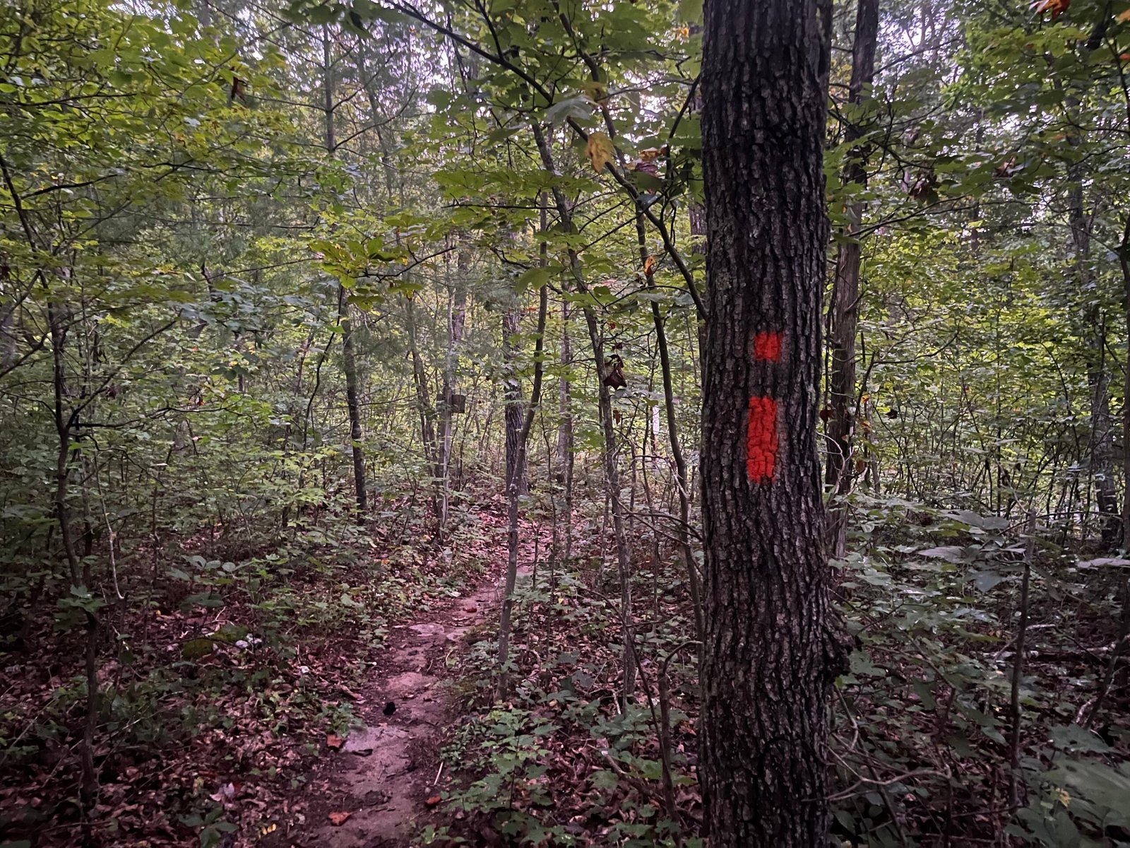
The first “official” Ring 2026 picture. Remember this blaze, ladies and gents, for you will come to know it well.
I walked to the “starting line” around 0650. This year, the Ring had around 40 official starters, and we gathered on the far end of the Signal Knob parking lot, opposite where the usual “party lot” is, and milled around as the training and planning became secondary to the reality staring all of us in the face. This wasn’t theoretical anymore; it was real. And as the Ring co-RDs Daisy and Lauren gave us all the usual pre-race briefing, I couldn’t help but get a little nervous. It’s honestly hard not to be, especially when you’ve ‘been here, done that’ before. I know what’s coming. As someone who repeats a lot of shorter events (50Ks and 50-mile races), I usually like this feeling. I treat most of them like training runs, so it ends up being just another long run (but with aid, and friends, and sometimes a sticker at the end). But when you go past 50 miles, you end up in a whole different world. It doesn’t matter what you think you know, because the distance always presents new challenges for you to work through. You can’t fake your way through it. This isn’t just another training run.
And at 0700…off we went.
The Start to Roosevelt (0 to 25ish miles).
I took off fast and found my way into second, behind Dan Fogg, in the day’s opening mile. Now, usually I wouldn’t recommend doing this unless your goal is to race/compete, as starting fast is a good way to dig yourself into a hole early; but for me, it wasn’t so much about running fast as it was about making sure all my gear was adjusted how I wanted it to be, avoiding getting caught in the conga line that forms when taking the Orange Trail from Singal Knob to Elizabeth Furnace, and, as such things go, having some space to think and reflect on how I wanted to tackle the miles ahead of me.
You see, I shouldn’t have even run the Ring this year. I know, I know–what the heck am I talking about? Well, as unsurprising as this might be, we ultrarunner types tend to make poor decisions, and I can think of no poorer decision than running the Ring a week before I’m supposed to run a 100-mile race.
Yeah, I know.
So as I’m heading up Elizabeth Furnace, which starts gradual and semi-technical before transitioning into steeper pitches with loose and angled rocks almost everywhere, I’m working through how I want to pace this 71 miles of technical mountain running, so I don’t destroy myself going into next weekend’s flat and fast 100-mile effort at the Pine Creek 100 in Pennsylvania.
(Again, don’t take scheduling advice from ultrarunners.)
I reached the top of the mountain in around an hour or so, and immediately implemented what became the day’s mantra: treat it like a fastpacking route with some running thrown in. This seems obvious, but it was a revelation to me in the moment. You see, in the two prior years, I had attempted to treat the Ring like other, similar events (MMT 100) in the area, and had been left, even when I finished in 2025, mentally ground down and worn out. But this year?
Well, let’s not get too far ahead.
The section to Milford Gap is quintessential Ring. You follow a path littered with rocks here, more rocks there, and, well, even more rocks everywhere else. It’s got short, steep climbs to break things up, loads of tree-covered singletrack, and the occasional section where you ask yourself, how on earth can this be a trail? During this time, I fell into a group of four, including eventual finisher Mark Carter, 22:20, who was filming a YouTube video of his experience that weekend out on Orange. He and I shared the next couple of miles, chatting the typical get-to-know-you ultrarunner conversations. It was during this, around 8 or so miles in, that I took my first of two falls during the day. Thankfully, it came on a relatively mild section, and I didn’t end up landing on any rocks, but it was a good shock to the system to remind me to slow down, which I did. I began to walk more, doing everything I could to keep the HR low, the pace consistent, and the fuel intake high. I should say that my nutrition plan revolved around rotating through a handful of options: Hammer, Honey Stinger, and GU gels, Honey Stinger waffles, Clif Bloks, fruit snacks, Tailwind, and whatever looked good at the aid stations (some soda, Gatorade, a piece or two of watermelon, Milford banana bread (yes), a burger from Mr. Jeff Best at Woodstock, and a few other small bites elsewhere). This plan worked well for the most part throughout the day, and I managed to remain consistent until the last couple of miles, when I decided to stop eating altogether.
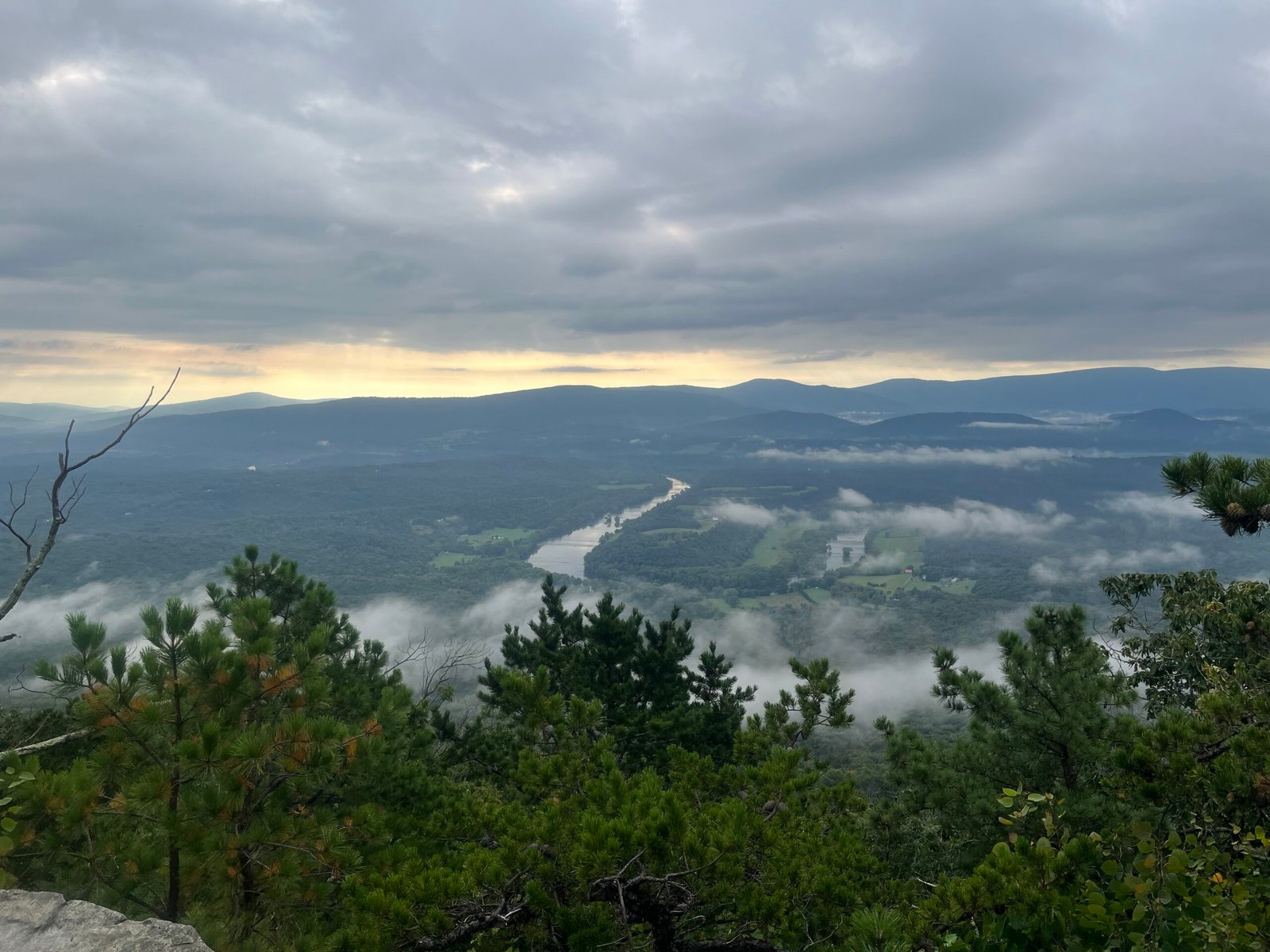 Viewpoint before descending on Orange into Veach, around mile 7 or 8. Notice the storm clouds.
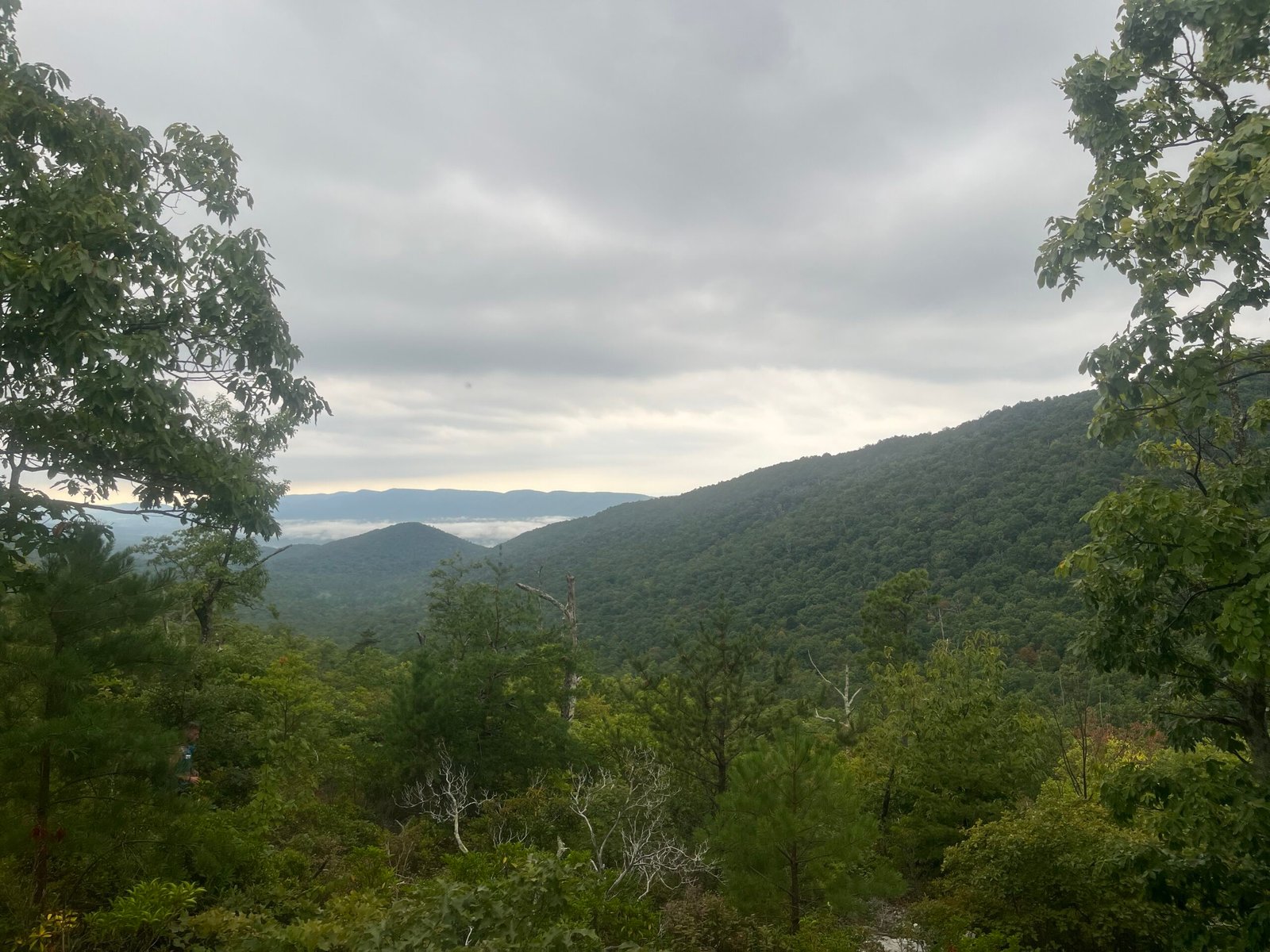 Final view before dropping below the treeline and into Veach
The descent into Veach went about as well, aside from the odd ankle roll, as it was going to go. I was no longer running with anyone at this point–Mark had gone ahead–so it was nice to dial back the effort and just cruise. I’ve been dealing with an ‘on again, off again’ knee issue for almost a year now, so I was glad not to feel anything as I navigated down the trail down, and then back up to the ridge. The trail on the climb from Veach back to the ridge was in noticeably worse shape than the descent had been, and the downed trees, overgrown vegetation, and loose footing made the climb a bit more difficult. But after a few minutes–okay, 20 or so–I reached the top, and then had around 3 miles to go before the water stop at Milford, mile 13.
Milford was a welcome sight. I wasn’t out of fluids, but I was low after 13 miles, and so I took the time to top off everything. As a volunteer was assisting me, another VHTRC regular, Jamie Greenawalt, asked me if I wanted some banana bread. I thought for a moment, mostly because of how unexpected it was. I don’t think I’ve ever had banana bread during an ultra, and I didn’t expect to have any here, but it didn’t take long for me to say, yes, please! A few minutes after arriving, I was off again with everything filled and some great banana bread to munch on.
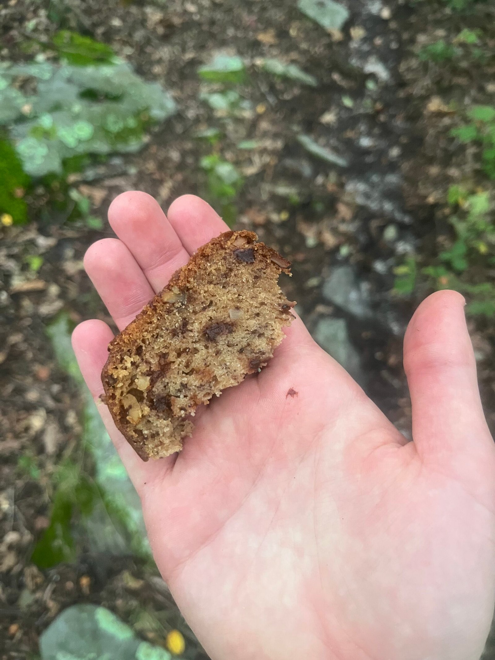 I remembered to take the picture after eating 1/2 of it, haha.
However, not everything was sunshine. I remember asking the volunteers at Milford whether it was supposed to rain, hoping I had at least a couple of hours before it would start. The thunder in the distance was answer enough. And less than 30 minutes later, we got drenched…for the first time.
I don’t mind a bit of rain. In fact, on a warm day like Saturday, a bit of rain can often be a welcome relief. But the Ring is different. Rain is fine, but what about when thunder is booming overhead, and lightning is flashing what feels like feet away? You’re also on a ridge with lots of trees. Trees are great, but when you mix ridges, wind, and trees, then you end up having to play dodge the projectile as one falls after the other (a look at the trail was enough to show you how often trees are knocked over on the ridge). Lucky for us, however, we only had to deal with rain, thunder, and lightning. Not a great combination, but much better than the alternative. I made sure to dial back the effort on some of the steeper downhills, as wet rocks are great for slip-and-falls, and falling then was the last thing in the world I needed.
After leaving Milford, you have another 12 miles of trail before reaching the first “real” aid station at Roosevelt. It’s a long 12 miles, and in all three Rings I’ve run, the hardest mentally for me to manage. It was during this time, while I was getting drenched in rain, that the dreaded “rationalization game” began to play out inside my head.
“You don’t need to be out here, you know? You’ve already done this before.”
“You have a race next weekend, idiot.”
“What if you hurt yourself?”
And on, and on, and on it went, like clockwork for the next 3 hours. I couldn’t understand why I thought this had been a good idea, and I chastised myself for being so foolish, arrogant, and shortsighted to have thought otherwise. The Ring isn’t just something you “do,” like you might “do” a 50K or 50-mile race. It’s the Ring. The Orange Trail grinds you down.
So I decided to quit. I texted a few buddies to let them know what I planned to do, and then resigned myself to the inevitable. I walked, ran a bit, and rehearsed the spiel I planned to give at the aid station. It’s a spot I’ve been in more than I like to admit lately. I’ve DNF’d my last three 100-mile races, including my favorite race, MMT, twice. Mentally, since the end of 2024, when I finished CAT 100, the long stuff has just eluded me. It’s been a mental grind to go beyond the 50-mile distance. What did it matter if I DNF’d another one? After all, it’s just a fatass “race.” I have a “real race” next weekend. I wasn’t quitting; no, I was doing the smart thing.
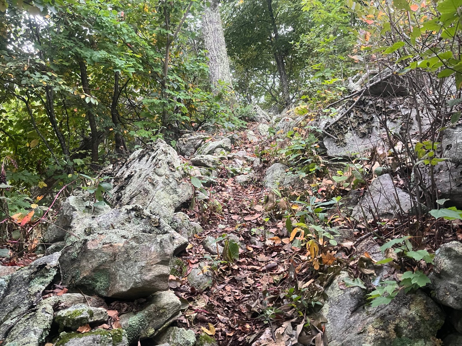 The Orange Trail between Milford and Roosevelt does have some uphill.
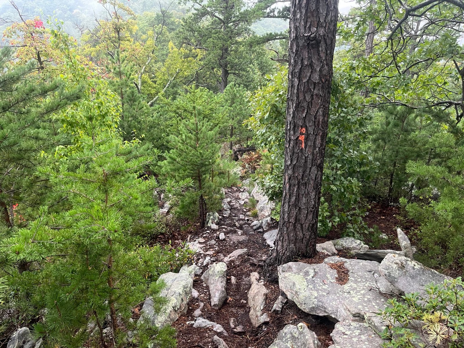 Wet rocks make descents like this extra difficult.
I made sure to stop before the trail junction where the turn onto Kennedy Peak and the descent to SR 675 is located to take in the view. I had never stopped here before. I guess in past years I had, for whatever reason, overlooked it. I felt sad that the day had gone off the rails so quickly, but repeated the tried-and-true “there’s always next week” rationalization.
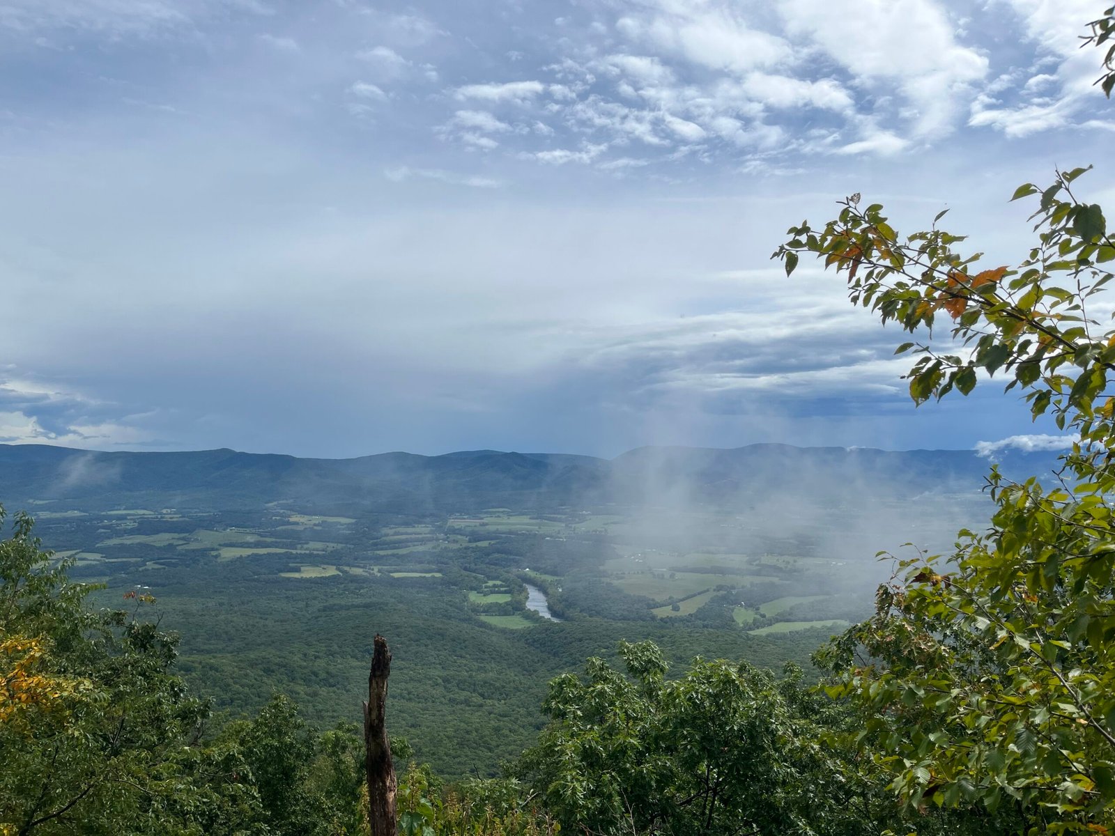 The view from the Orange Trail toward Shenandoah National Park.
The descent to SR 675 (the name of the road at the bottom of the trail) was yet another walk-and-shuffle. I was still moving well and was on target to hit Roosevelt, 25 miles, in around 6 or so hours. I was still eating (wait, hadn’t I decided to quit?), drinking, and taking pictures. Despite resigning myself, I think part of me, whether consciously or not, rejected the whole thing outright.
Quit again?
Are you serious?
Yes, I was.
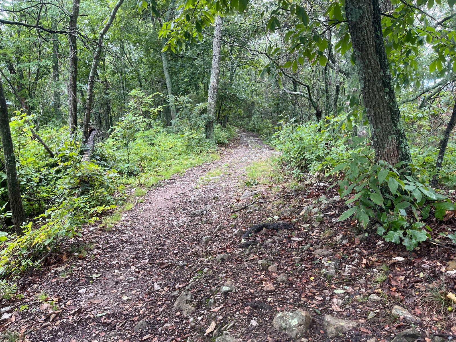 Part of the Kennedy Peak fire road to SR 675
As I reached the bottom of the trail, I saw VHTRC stalwart Marty Fox, sitting at the trailhead. He and I had had a funny interaction before the start when he mistook me for another runner (I guess we look the same, eh?), and this was the third time I saw him that morning (I also saw him at the bottom of Veach). He cheered me on, and it was good to run into someone so positive at a time when I wasn’t in such a good spot.
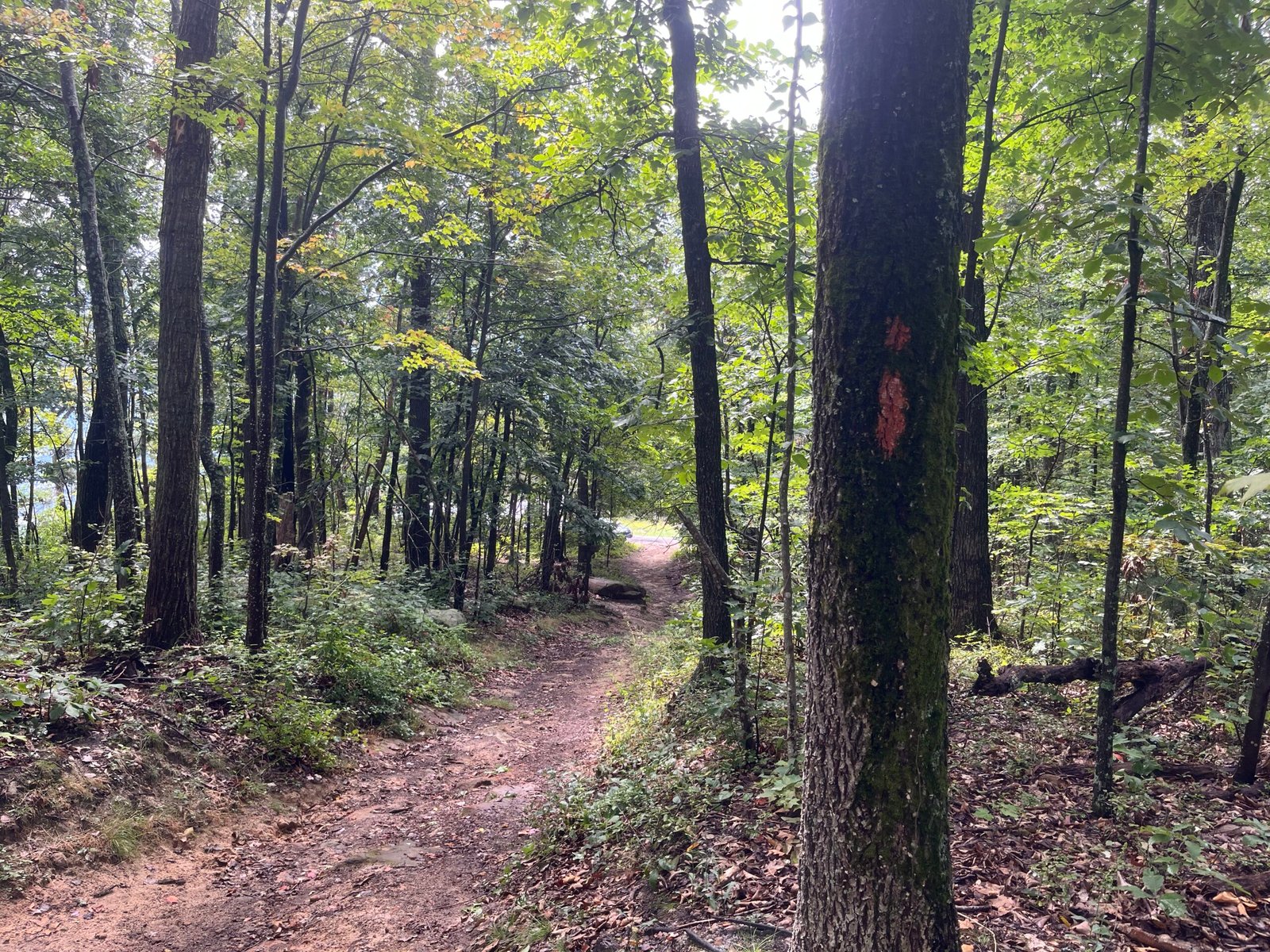 A welcome sight after 24 miles: the end of the first ridge before reaching SR 675.
The arrival at SR 675 doesn’t mark the end of the first section, however, as you jump from the road back onto the Orange Trail and descend to the Horse Lot. But before dropping down, I made sure to walk over to the paragliding launch point and take yet another two photos.
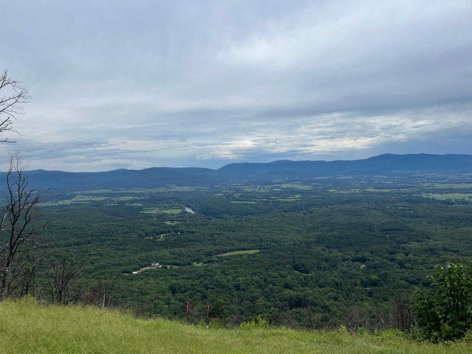 View from SR 675 toward Shenandoah National Park
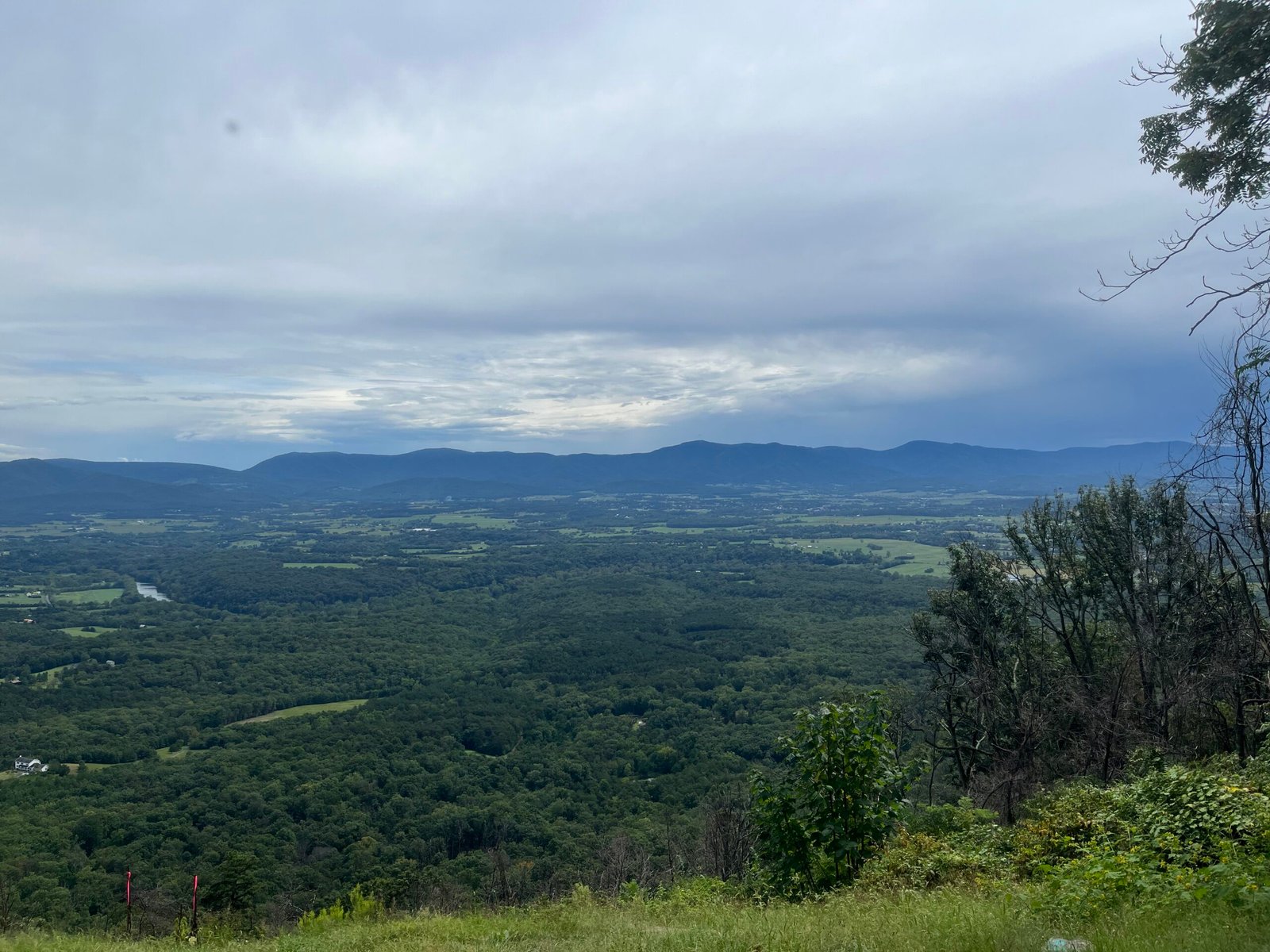 View from SR 675 toward Shenandoah National Park Pt.2
The section of the Orange Trail between SR 675 and the Horse Lot is mostly downhill. I wouldn’t call the descent “smooth,” but it gets less technical the closer you get to the bottom. I got passed here by at least three people, which was interesting because I hadn’t been passed by anyone for miles before that. I suppose when you’re walking as much as I was, it’s bound to catch up with you at some point. I was still somewhere in the top ten, but even that seemed like little consolation. I made the final descent onto the gravel at the Horse Lot with 6 hours and change on my watch, and could see the road, SR 675, at the end of the driveway that would take me to Roosevelt, where I would end my 2026 running of the Ring.
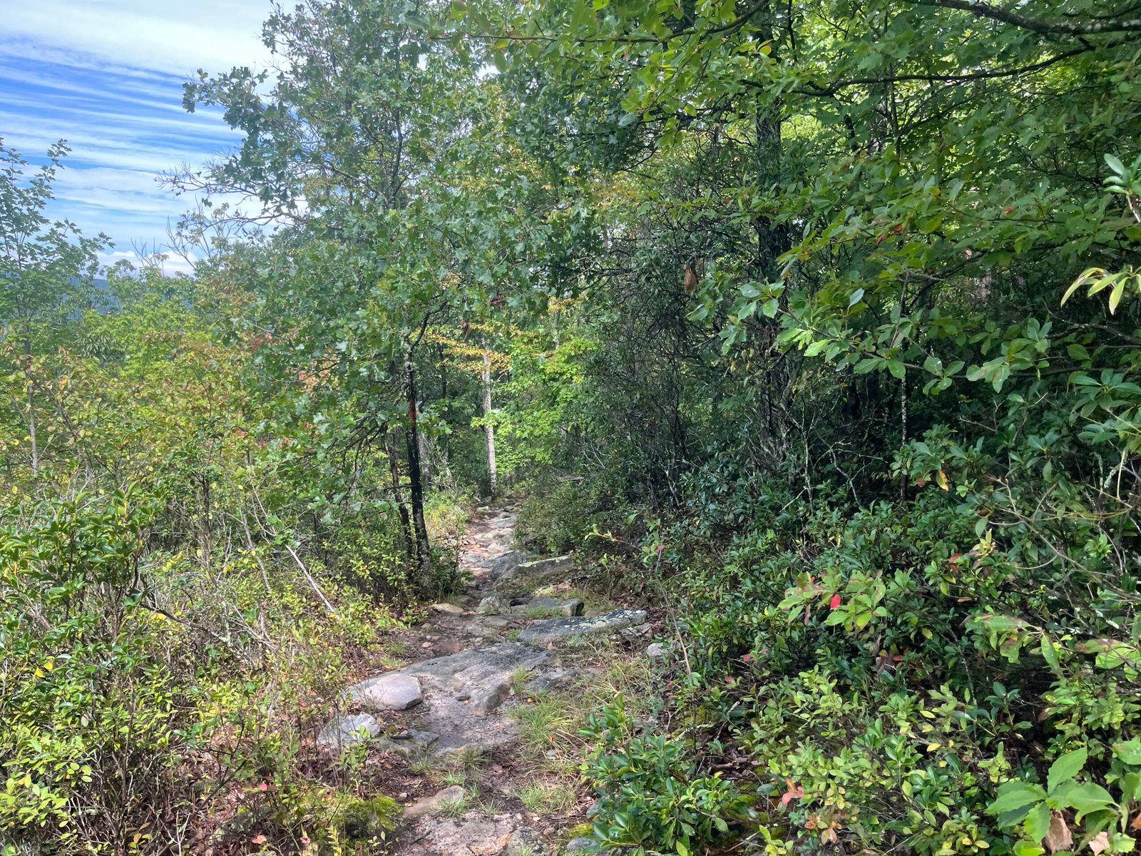 The upper portion of the Orange Trail descent to the Horse Lot.
So what happened? In a nutshell, I arrived at Roosevelt with every intention to drop, but. . . . But I just couldn’t do it. Call it pride, stubbornness, foolishness, or whatever you want, but I couldn’t quit the Ring yet again, simply because I didn’t feel like being out there anymore. I wasn’t injured, I wasn’t tired, and I wasn’t here at the expense of something back home. Nope. I simply wanted to quit, because I wanted to quit. What kind of excuse is that? It’s the same excuse that’s gotten me in my last couple of 100-mile races. It’s a bad one. And so instead of just throwing in the towel, I went through the familiar motions. I got my drop bag, removed what I needed and left what I didn’t, and made sure to top off my fluids and nutrition. I drank some Coke, had a piece of watermelon, and then, after 5 or so minutes at the aid station, took off.
I wouldn’t call this a turning point, per se. It was more of a rebellion against what I view as my own internal logic. You see, I can rationalize almost anything when I want to do so. I can convince myself that quitting isn’t just the smart decision, but it’s the only one. I have X, Y, and Z going on, as well as this, that, and the other, so what am I doing here? But this sort of mindset, while good in some situations, is absolutely awful in races. You’re going to go through low spots over the course of a long ultra. At times, you’re going to want to quit. It’s inevitable. But the trick to being a “good” ultra runner is being able to recognize that, yes, these feelings are legitimate, but they’re also a product of the moment. I want to quit now, but will I feel the same way in 20 minutes? 60? 2 hours? Unless you’re injured, I don’t think so.
This is especially pertinent at the Ring. The first 25-mile stretch is hard. It’s exactly the type of section that puts you in the “quitter’s mindset.” Call it what you will, but I doubt anybody reaches the first aid station at Roosevelt without the thought of quitting somewhere inside their brain. The trick is to just go through the motions. Don’t think about the 46 miles you have left (easier said than done). Top off your fluids, eat something, and get out as quickly as possible. The longer you linger, the more likely it is that you’ll pull the plug.
Roosevelt to Edinburg (25ish to 48ish miles).
The next section is arguably the hardest of the entire Ring.
Even harder than the first 25? Yes.
It’s comprised of four distinct “segments.” These are Duncan Hollow, the climb up Waterfall, Kerns Mountain, and Short Mountain.
As I left Roosevelt and began walking up the road to where Duncan began, I struck up a conversation with another runner, Yogi, who happened to be leaving at the same time as me. He and I would run the next section together until the base of Waterfall. Yogi is an Indian ultra runner who moved to the United States around 6 years ago. In that time, he’s become a 5-time finisher of the Mantiou’s Revenge 54-mile, one of the hardest sub-100-mile races in the United States. He’s also finished numerous other ultras and is planning to do his first 100-mile race in 2027 at the Eastern States 100 in PA. We spent the section through Duncan exchanging ultra talk, including our thoughts on the commercialization of the sport, our mutual dislike of lotteries, and how sometimes it takes an event like the Ring to remind you what ultra running is all about. Unfortunately, Yogi ended up dropping at some point after we separated on the climb up Waterfall.
As for the section we ran together, Duncan Hollow, of Old Dominion and MMT 100 fame, I think pictures will do a better job of showcasing its unique characteristics than words ever could.
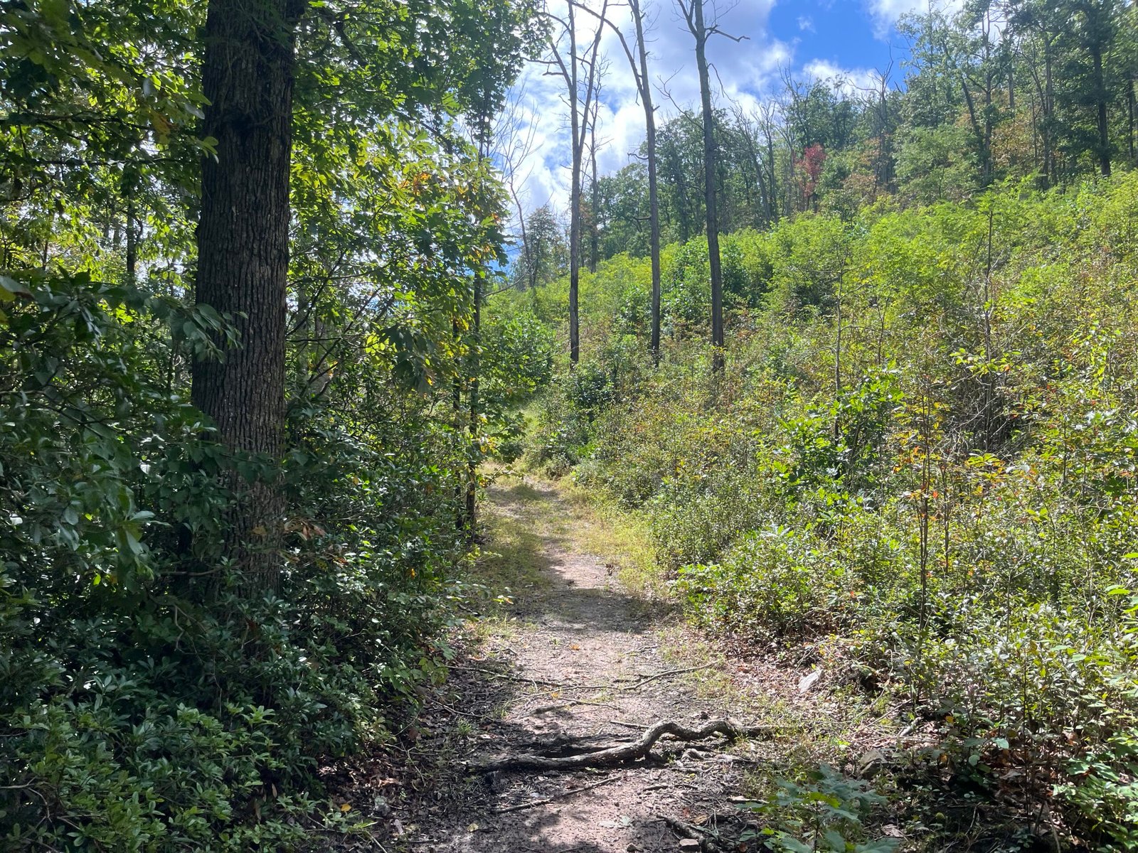 Early Duncan. Not too bad, right?
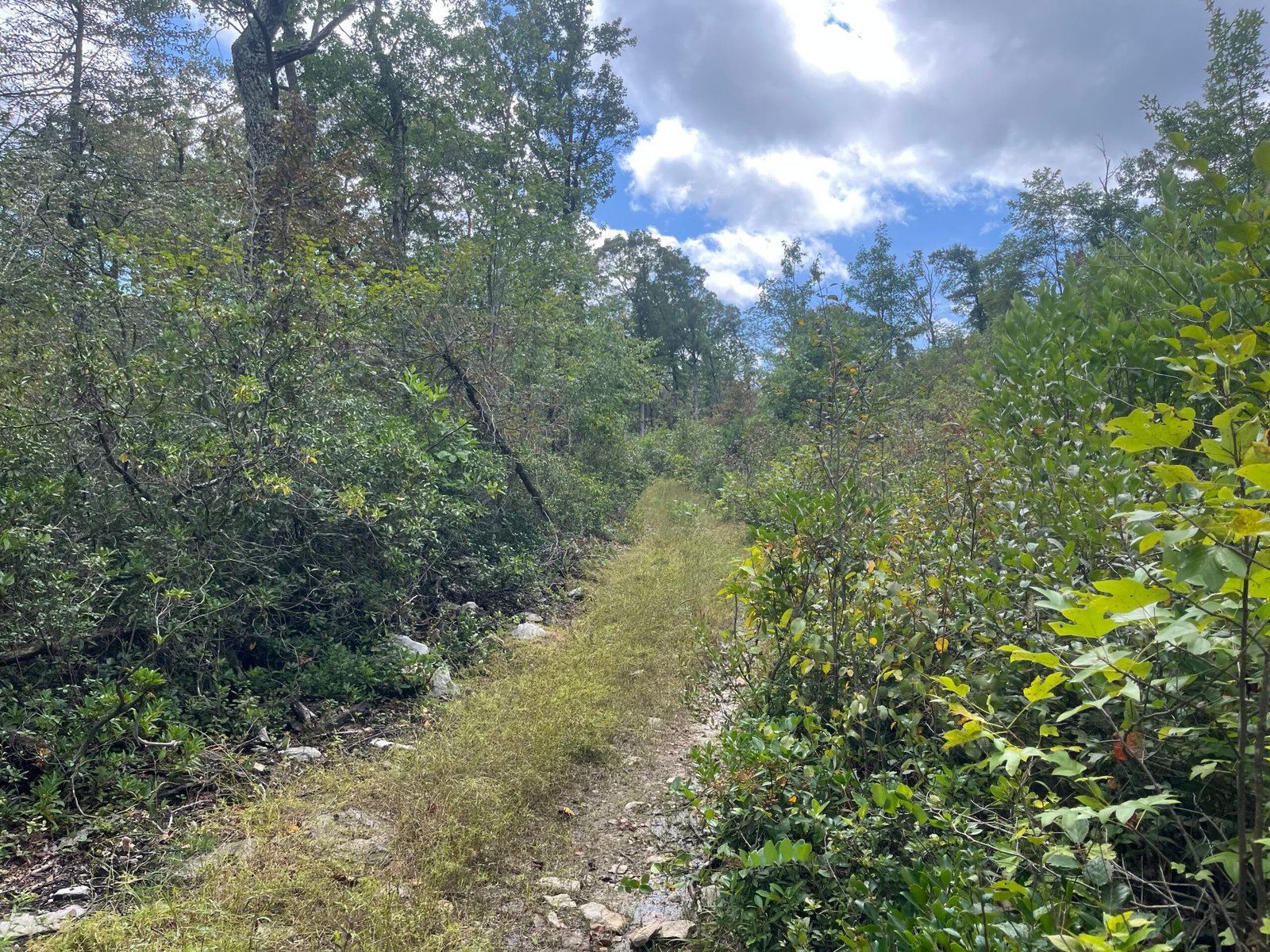 Wait a second, we go there?
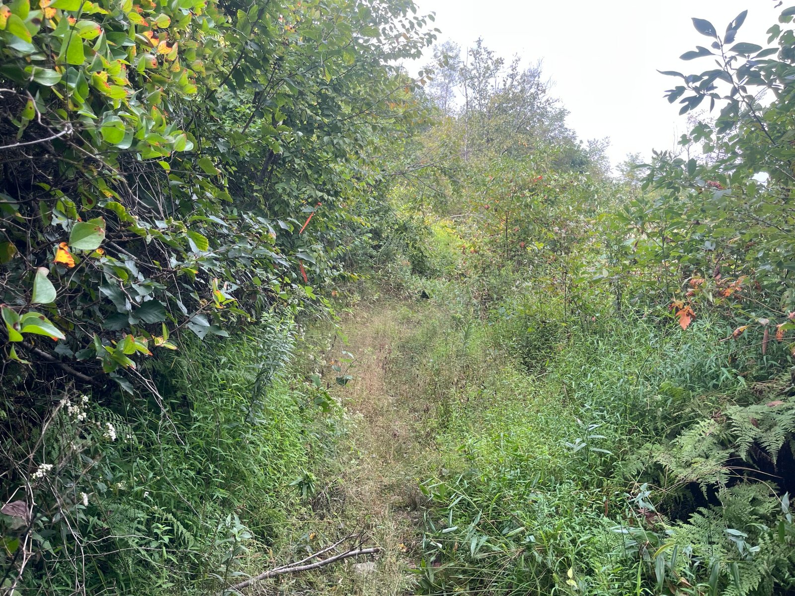 Yes, that’s the trail. Don’t you see it?
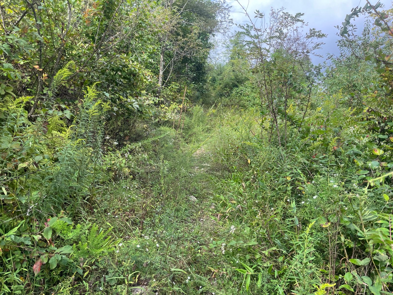 This is never going to end, is it?
Duncan is like the opposite of a bad dream. As any good dream surfer knows, you can wake yourself up from a bad dream if you want to do so. With enough practice, it can be like flipping on and off a light switch. But Duncan? Duncan is no dream. It’s miles of steady, yet ever so slight uphill that grows wilder the closer you get to the top. The trail all but disappears in spots, becoming a tangled mess of vegetation, hidden rocks, and the ever-present threat of snakes under every step. The trail has little to no shade cover, in part due to fires in recent years, and when the sun is high, so is the temperature. You bake as you trudge along, unable to pick up the pace without having your heart rate spike to the moon. This is a good section to walk. It’s not steep enough that you can’t average a good pace, so walking (with some running) provides the best solution to its many problems. It’s a tolerable section if you don’t fight it. Best of all, it rewards you at the top for your patience with a decent view.
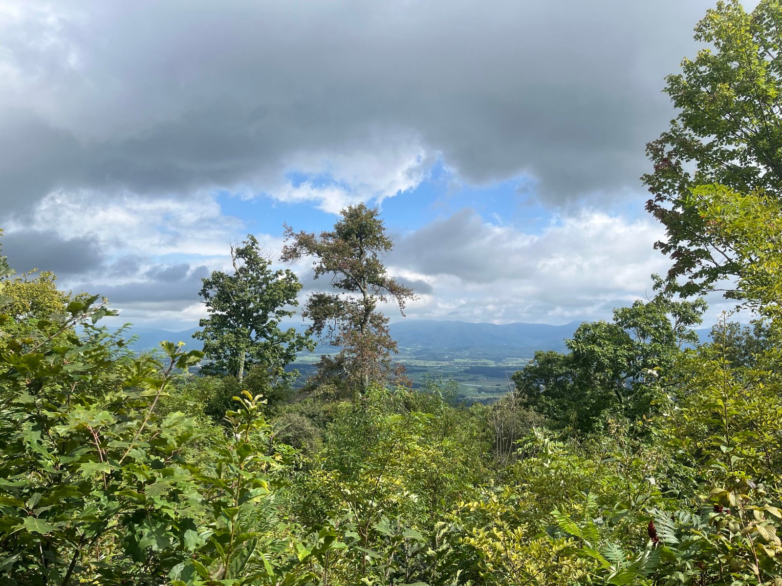 The view from the top of Duncan before you begin the descent to Waterfall.
As we descended toward Waterfall after Duncan, I felt good. I don’t know what it was, but everything was clicking. The thoughts from earlier, which nearly ended my day, were no longer there. I was focused, dialed in on the present section and not anything beyond it, and moving well. Yogi and I came across Marty Fox, yet again, this time at the sharp left turn at the bottom of the descent off Duncan. He was cheerful as always, and I was glad to see him again.
The next few miles sort of blurred together. This is a familiar section to anyone who has run MMT before, as you hit this section after crossing Route 211, 90-something miles into the race. The only difference is that during the Ring, you’re running the section in reverse, and you don’t go all the way to the bottom; instead, you run about halfway down before making a sharp right turn onto the dreaded Waterfall climb.
I don’t have any pictures from Waterfall, in part because it started to rain hard for the second time that day as we started to climb, but mostly because of how hard Waterfall is. The last thing I was thinking about was pulling out my phone and taking photos as I climbed up, up, and up some more. I don’t have the exact details (vertical feet and so forth) on the climb, but anyone who has gone up Waterfall before knows how steep it is.
Like, steep.
Like, ouch, steep.
It was here that Yogi and I separated. He was dealing with some cramping issues, so I went ahead and powered up the climb solo. I consider myself a good climber, and I have always been able to deliver a consistent pace on uphill sections. Even late into 100-mile races, I don’t slow down much on the climbs, even if I have to breathe a bit harder to maintain a similar effort. This remained true on Saturday, and I made it to the top of Waterfall in one piece and was even able to run the trail to the aid station at Crisman Hollow Road. It was at the top of Waterfall where I ran into Mark again, for the first time in about 4 hours, after we had separated on the descent into Veach earlier on in the run. He was tired from the climb, but determined. The rain, of course, continued to come down hard for the next 20 or so minutes, and by the time I arrived at the aid station at mile 34ish, I was once again drenched.
After going through the standard aid station procedures, all while hiding under a canopy, and seeing fellow VHTRC members Lisa Peabody, Charlene Howard, and, of course, Quatro Hubbard, I took off up the trail to tackle Kerns.
Ah, Kerns. What a sadistic piece of trail you are, old friend. (Can I call you that?) But before getting into what makes Kerns, well, Kerns, I want to share another picture (or two).
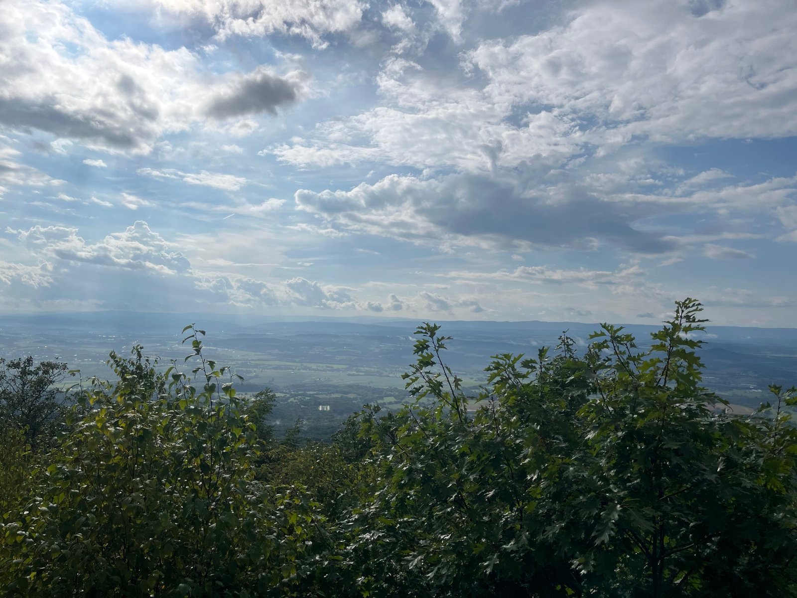 The iconic Q’s view
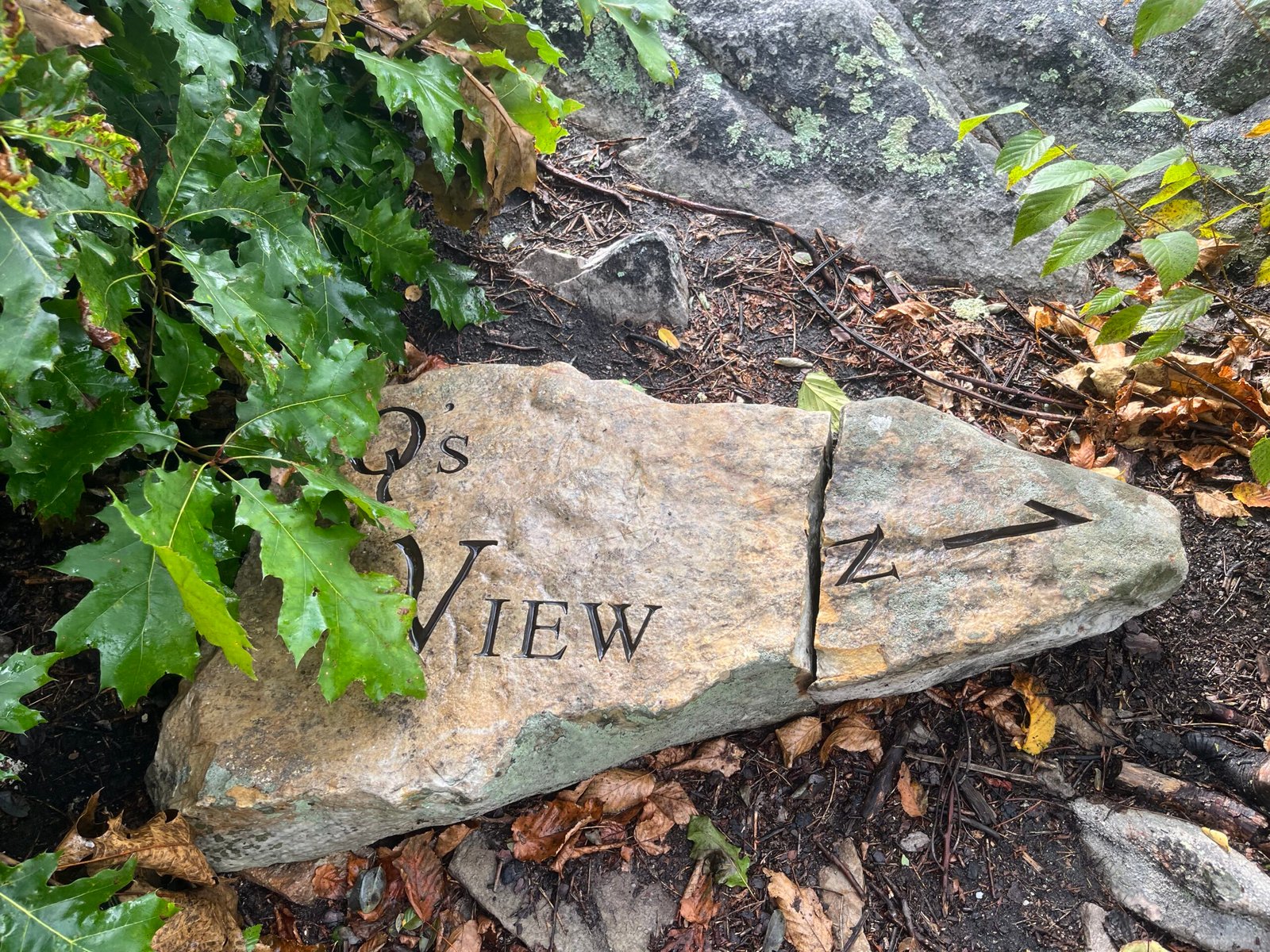 Plus the most photographed rock on the entire Orange Trail
Yes, where was I?
Kerns, right.
Kerns is Kerns. To describe it would be to diminish it. Sometimes the mystery needs to be preserved, so forget descriptions of the endless boulder fields, the sharp edges, and how damn dangerous it can be when all these things are drenched in rain. Instead, let me provide a few tips.
First, in the Ring, Kerns starts relatively easy before becoming quite hard. Once you go through the switchback (you’ll know the one), then you’ll be in the thick of it. Don’t fight the trail. You won’t be able to run it, believe me. Walk and preserve yourself. Breaking an ankle here would be bad.
Second, Kerns doesn’t last forever, but it might feel like it does. In actuality, the hard part of Kerns is “only” a couple of miles. The rest isn’t much different from what you’ve already done, at least to me. Don’t let visions of monstrous rocks intimidate you. Tackle it like you have everything else.
Third, the descent off Kerns is rocky and technical near the top, less so at the bottom. This section is runnable, but be careful.
The transition to dirt (you’ll know when you see it) is your sign that Kerns is over. From there, it’s about a mile or so to the aid station at Moreland Gap, mile 40ish.
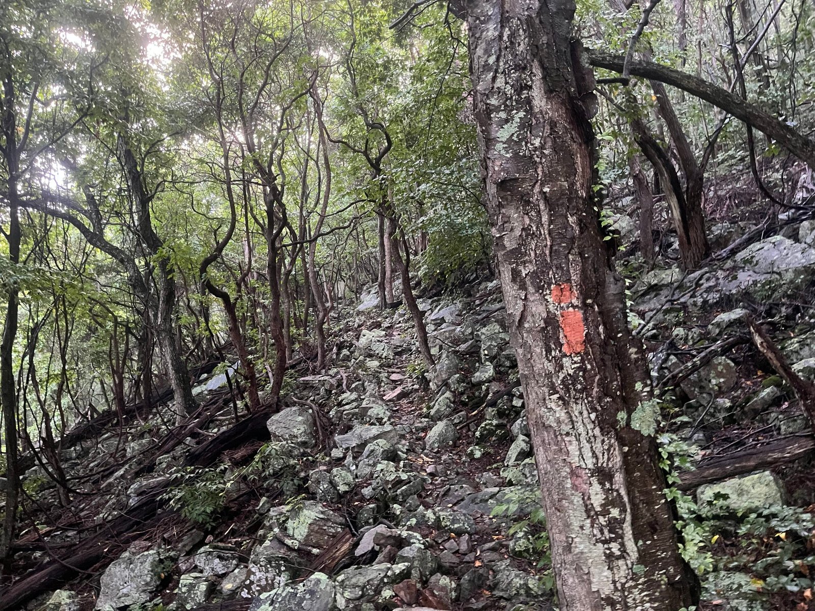 Not the entire descent from Kerns looks like this. Just most of it (that’s a joke!!).
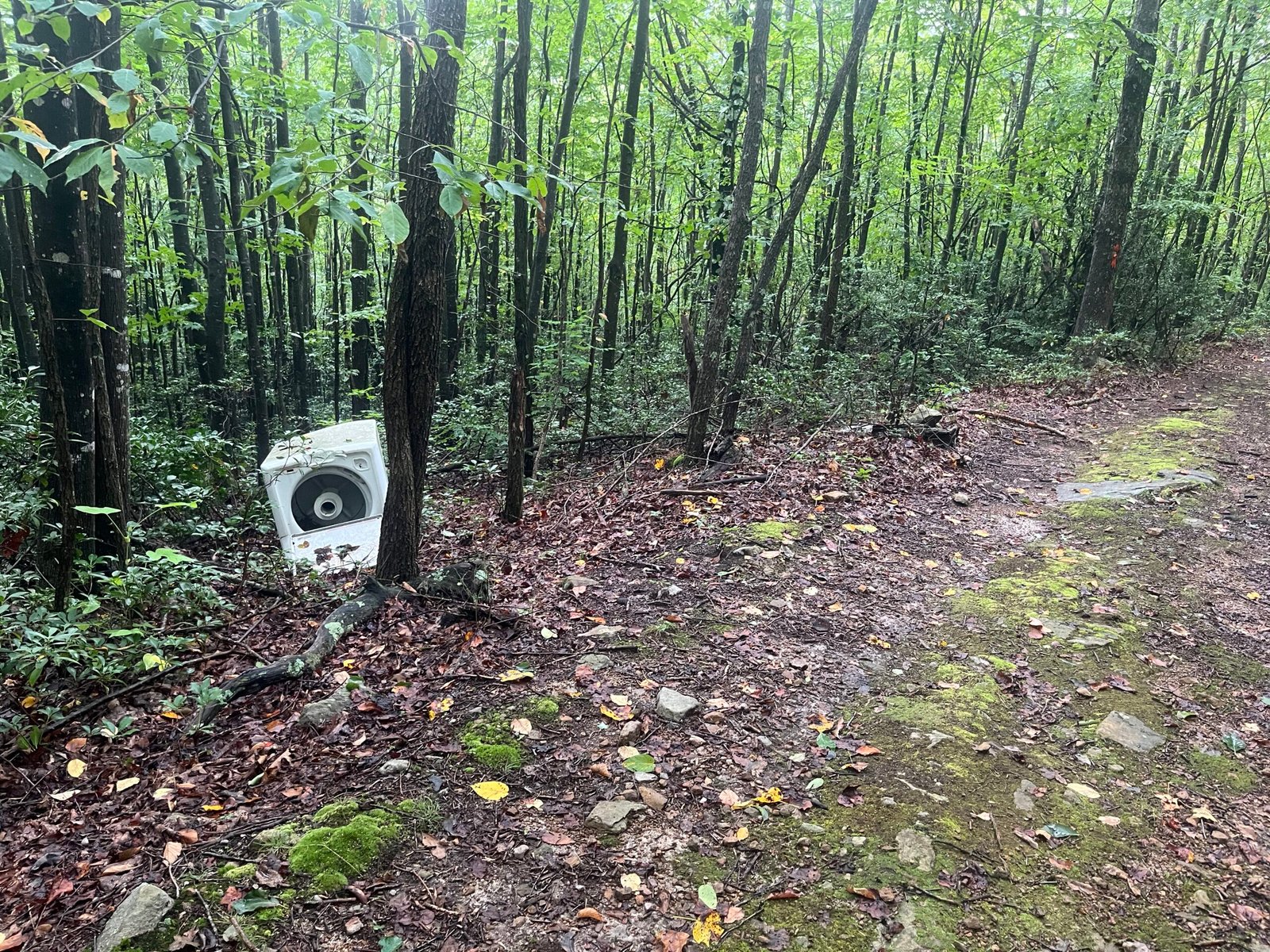 When you see the washing machine, you know the hard part (for a few minutes at least) is over.
Moreland to Edinburg sucks. Short Mountain, to me, is worse than Kerns. This first half of the trail on the ridge (before the descent to the road) is my least favorite section of the Ring, MMT, and basically everything else. Something about it just doesn’t work with me, and I’ve never been able to nail it down, despite running it dozens of times over the years.
The aid station at Moreland, however, is great. Something about seeing so many happy and helpful people after stumbling and bumbling your way through Kerns is always a treat. Of course, Moreland holds a special place in my Ring history, if you will. It was here, in 2024, that Randy and I dropped out with 16-plus hours still left to cover 30 miles. (Yeah, I know, weak sauce.) The DNF in 2024 was my fault, though I don’t think, in the moment, Randy was going to fight me over it (we both returned in 2025 and finished).
It was at Moreland that I decided to change my shirt (instead of waiting, like I originally planned to change it at Edinburg). Of course, it was also here, as I prepared to leave, that it started to rain again. Hard. Great. I hadn’t used my rain jacket once throughout the day because it was too warm, so I ended up just getting soaked again. Oh well, what can you do?
The section from Moreland to Edinburg is when it got dark for me. I had put on my headlamp and waist lamp at Moreland, and managed to make it about halfway through Short Mountain before I needed to turn them on. The rain let up after about 30 or so minutes, leaving behind a fog that would linger for the rest of the night throughout the trail.
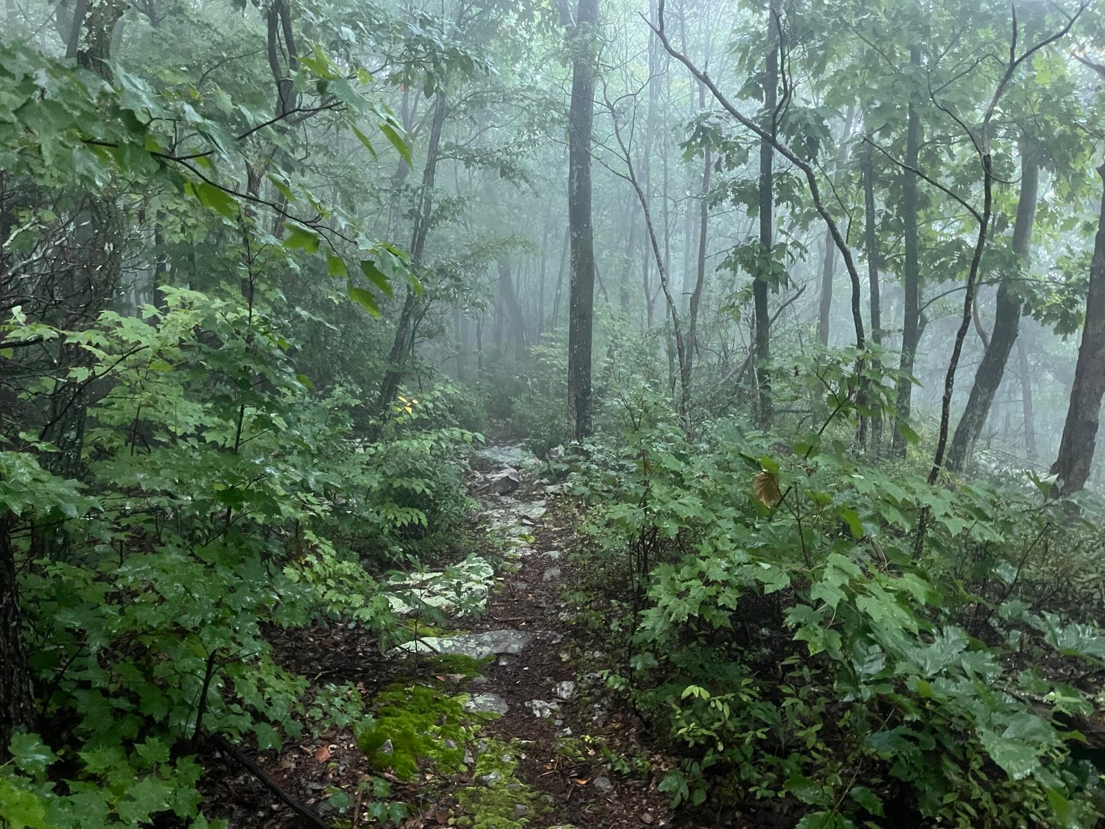 The final photograph from the 2026 Ring at the top of Short Mountain. You can see the beginnings of the night’s fog.
Speaking of the trail, have you ever heard of Ring Rash? Of course not, because you’re not insane. Anyway, Ring Rash is the colorful name given to the absolute beating your exposed skin will take over the course of this event. It’s not enough that the trail is steep, technical, wet, and unrelenting, but it’s also overgrown. And there’s no worse section on the course than Short Mountain. I will spare you the grizzly photographic evidence (you’re welcome). Just be prepared for it, cause it did hurt. A lot.
Excluding the Ring Rash, the most memorable part of this section for me was how it ended. I never handle the night well, no matter what I’m doing; I’m someone who goes to bed early and wakes up early, so staying up through the night is always tough for me. I tend to lose track of my surroundings at night, not to the point where I’ll get lost, but I have trouble keeping track of landmarks. Case in point: on Short Mountain, I reached the end well before I thought I was going to. I still thought I had the long downhill section at the end to contend with; well, it turns out I had already completed the long downhill section without realizing it, ending up at the road descent to Edinburg. This was a welcome development, though I’ve had situations in the past where that wasn’t the case.
I arrived at Edinburg, mile 48-ish, well after dark. I believe it was close to 2100, so around 14 hours in. Not too bad, all things considered. I was still feeling “good” for the most part. All that remained between me and the finish line was around 23 miles of Orange Trail fun.
Edinburg to the Finish (48-ish to 71 miles)
I won’t go into too much detail on the section between Edinburg and Woodstock, or the section from Woodstock to Powell’s Fort. You know the deal at this point, I think. It was technical, slow, foggy, and dark. I’m so familiar with this section that I knew it would take north of 6 hours to get through. (After all, 23 miles at the end is quite the distance to cover.) In reality, it ended up taking almost 7 hours to get from Edinburg to the finish, so around hour 14 to right at 21. I stopped once, at Woodstock, to eat a Jeff Best cheeseburger, which was quite good, though I think I would’ve enjoyed it more if I were on the other side of the table, haha.
During this section, I linked up with Cam Baker, a veteran of the Massanuttens. He’s finished the Ring and Reverse Ring enough times to make you question his mental faculties, as well as numerous 100s and other ‘grand’ adventures. He and I shared stories, though we spent quite a bit of time yo-yoing with one another, as he would hike faster than me on the flats, and then I would catch him on the climbs and descents. Cam’s about as old-school as they come, and I can see how an event like the Ring would appeal to someone like him. He embodies the ultra ethos I try to hold myself to as well, even though I sometimes fail to live up to it.
What I will touch upon is the section from Powell’s Fort, the final aid station around the 100k mark, to the finish line at the Signal Knob parking lot.
(Note: The Powell’s Fort aid is great, though I felt bad about not being able to eat anything.)
The Signal Knob trail is tough. Just because it’s at the end doesn’t mean it’s a walk in the park. The climb up to the overlook is steep, but it’s on a service road, so it’s not too bad. The overlook at Signal Knob is interesting at night because you can see the lights of Front Royal down below. But then it’s back to climbing. (It never ends, does it?) You go for about a mile like this before it levels out, and the downhill to the finish begins.
Downhill? Finish? Check, check. Awesome, right?
Right?
Hold your horses there, buckaroo. No, you won’t be flying down the final 2 or 3 miles as you chase down seconds on the clock. In fact, I would imagine most participants find the Signal Knob descent to be one of the most challenging on the entire course. It’s steep, littered with ankle-breaking rocks, dark as hell out, and overall not conducive to quick movement. The last couple of miles are the final punishment for those stubborn enough to have seen the whole thing through. The trail offers no respite, even at the end. Suffering is optional, but the Ring. . . .
Eventually, though, it does end.
Thank God.
Aftermath and Closing Thoughts
21 hours and 9 minutes later, I was done. After securing my hard-earned sticker and having a quick parting conversation with Cam, I walked over to where I had parked what felt like a lifetime ago. 30 minutes later, around 0445 or so, I was on the road home. The 2026 Ring had come to an end.
It would be criminal to end this report without first thanking all the volunteers for giving up their time to help shepherd us through this epic challenge. Whatever your opinion on something like the Ring might be, one thing that cannot be argued is that the volunteers are what make events like this possible. I also want to thank the VHTRC, of which I have been a member since 2019, and Co-Race Directors Daisy and Lauren for making sure everything and everyone was where it needed to be. You all rock.
I also want to thank Mark, Yogi, and Cam for sharing the trail with me this weekend and making the 2026 Ring an experience to remember.
Special shoutout to everyone who lined up this weekend, whether you finished or not. Sometimes starting is the hardest thing to do. I hope to see all of you out again on the trail in the future.
As for me, I’m very satisfied with how this year’s event went. To go from wanting to quit at 25 to having my best “Ring experience” yet was a welcome surprise. I thought this would be the last time I ever attempted this, but now I’m not so sure. I know the Reverse Ring will be on the calendar next year, but we’ll see about this one. I think I’ve cracked the formula for how to approach this event, but I know that’s when the script will be flipped. What worked this year might not work again in the future. There’s a lot of luck that goes into finishing these things.
Until next time.